Trail Tourer

The Central South is built for long pedals, great snacks, and detours that feel better on two wheels.

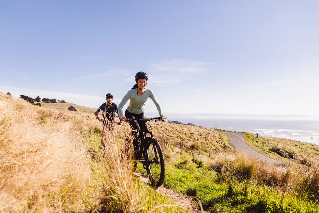
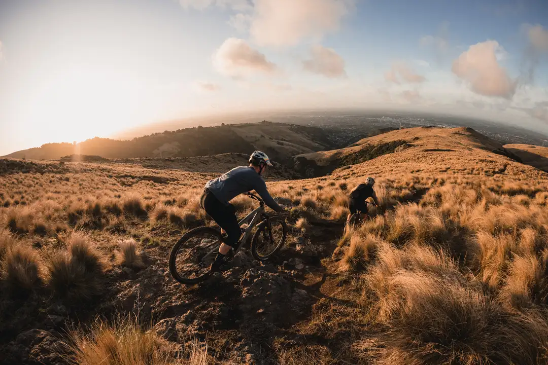
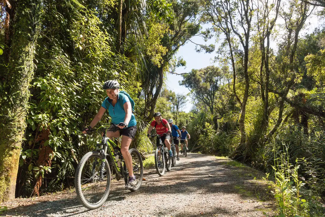
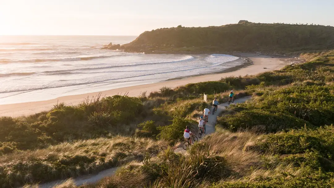
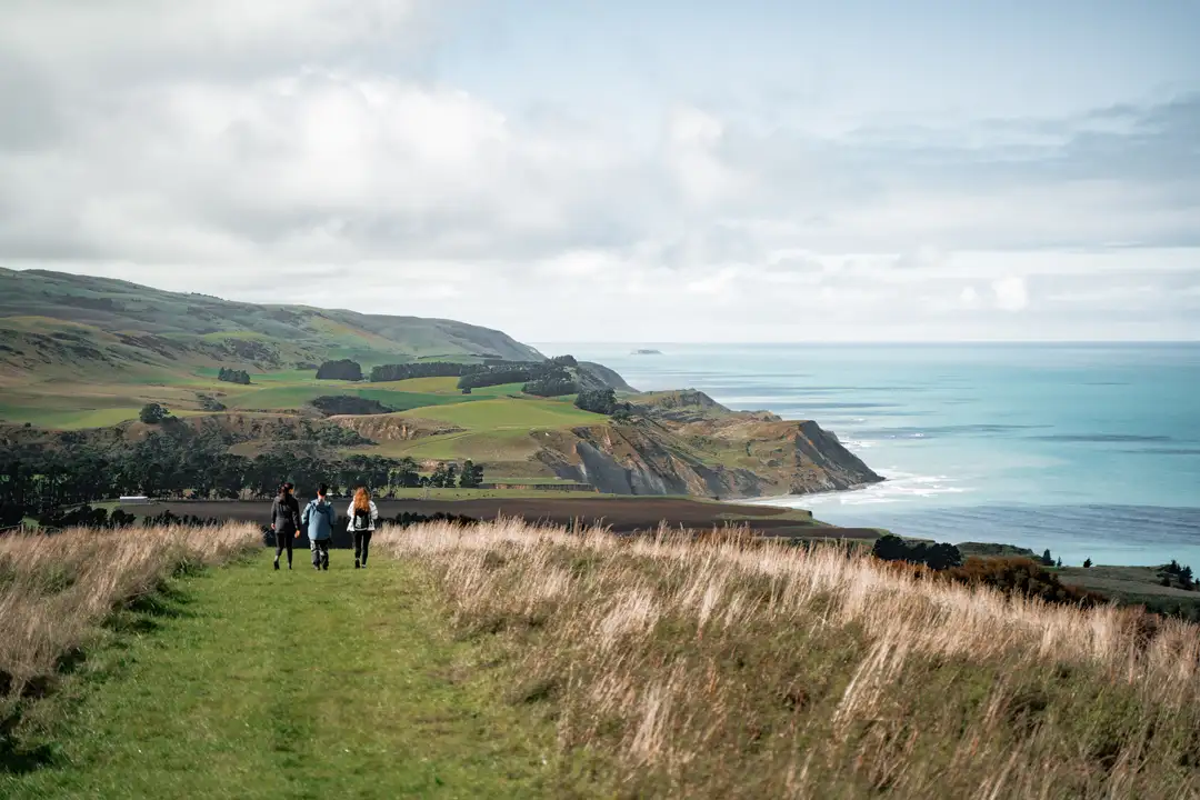
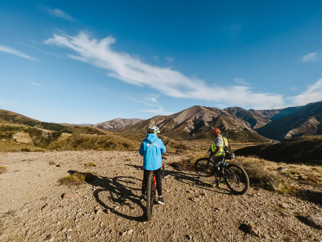
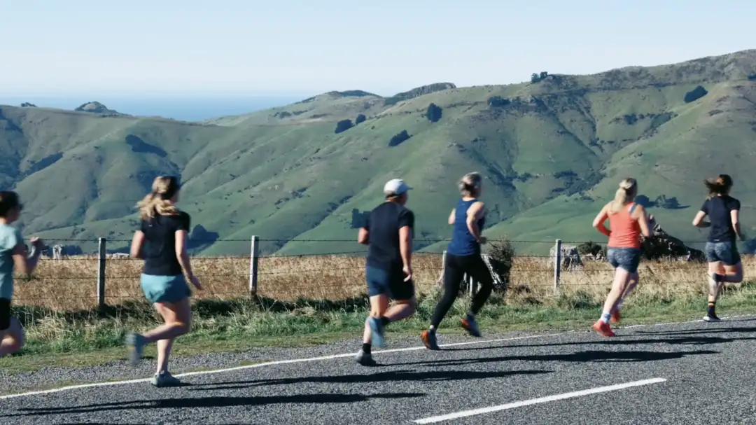
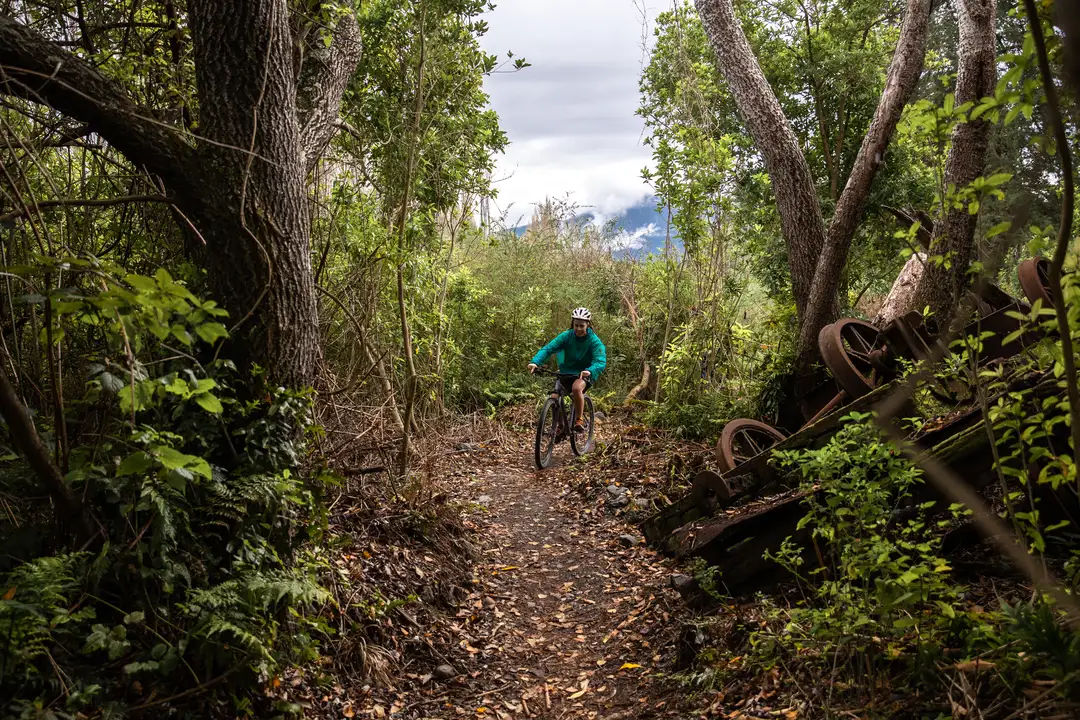
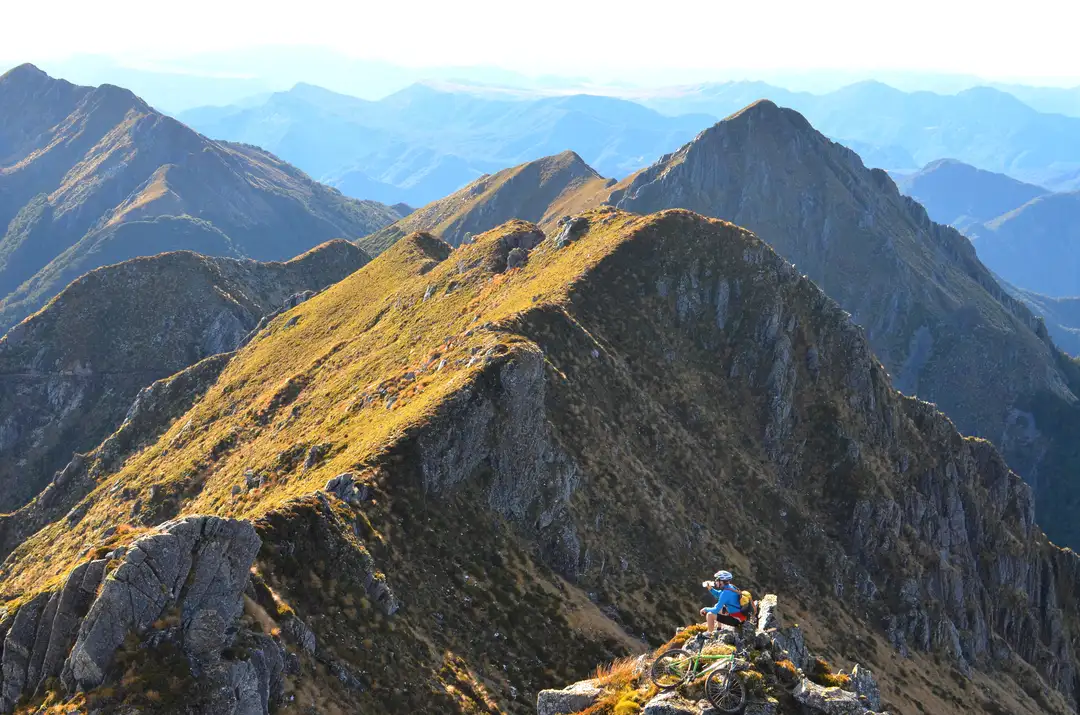
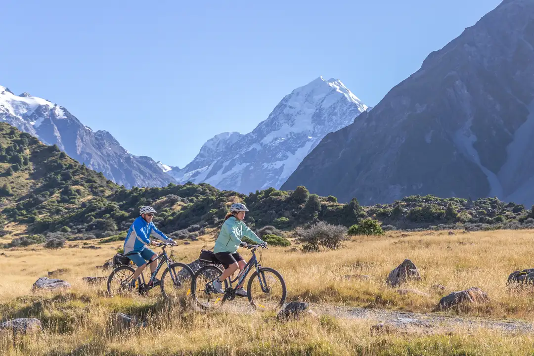
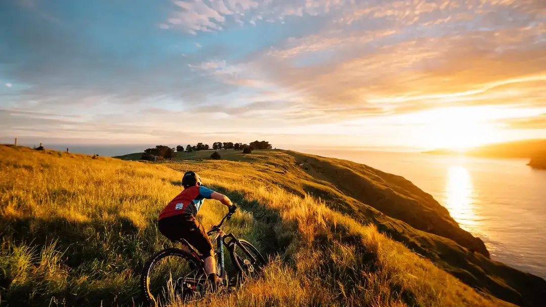
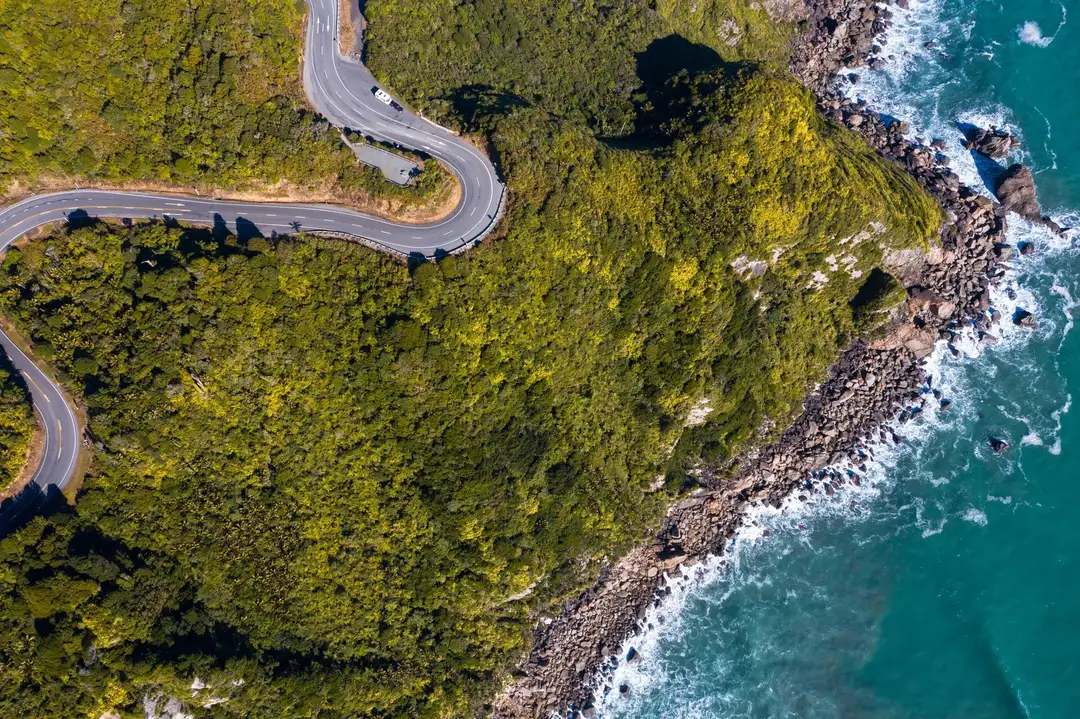
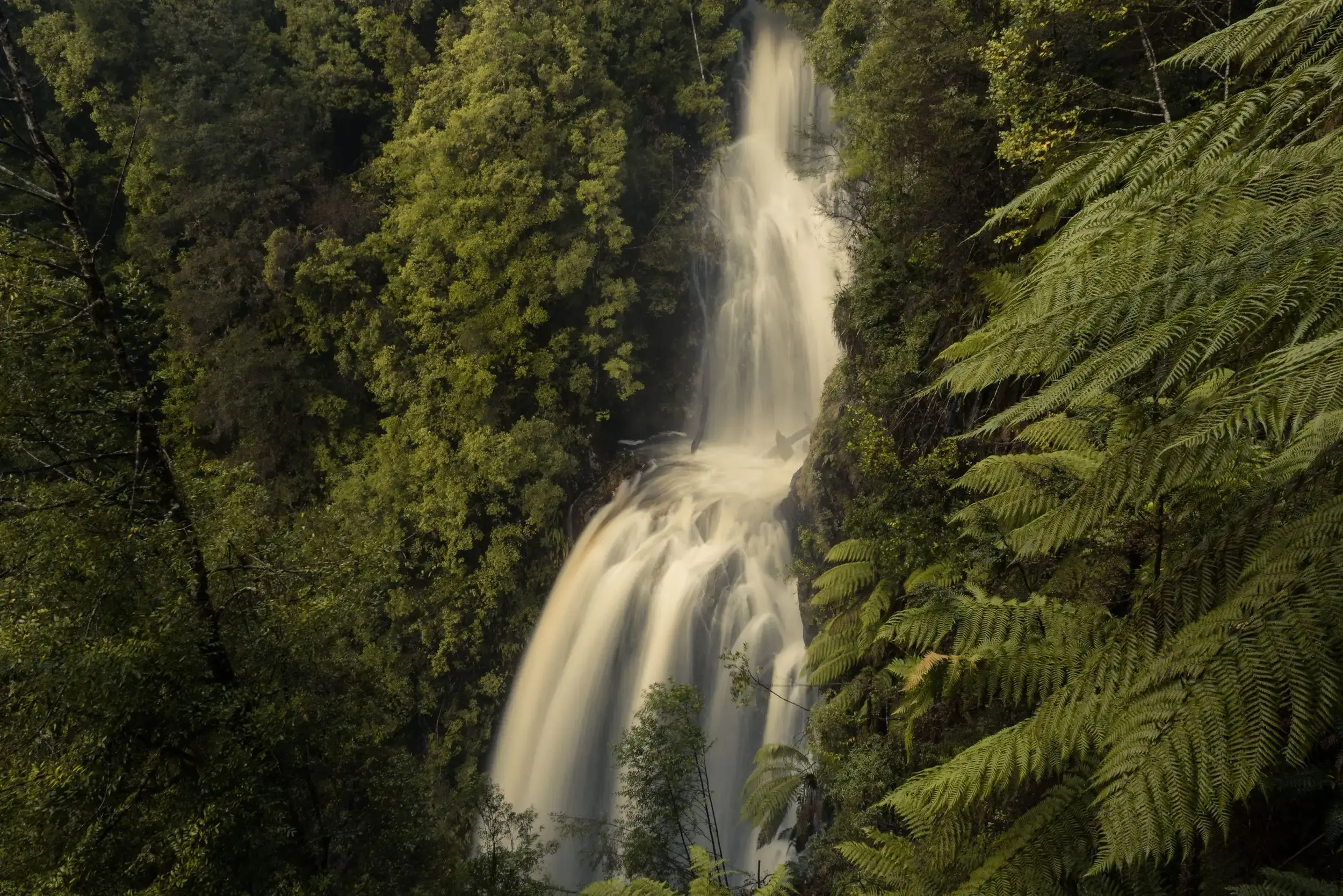
You’re not racing — you’re exploring. Wide trails, steady climbs, forest loops and vineyard rides. The Central South is built for long pedals, great snacks, and detours that feel better on two wheels.

<svg viewBox="0 0 24 24" fill="none" xmlns="http://www.w3.org/2000/svg"><path d="M17.644 20.23a2.69 2.69 0 1 0 0-5.378 2.69 2.69 0 0 0 0 5.379Zm-11.954 0a2.69 2.69 0 1 0 0-5.378 2.69 2.69 0 0 0 0 5.379Z" stroke="currentColor" stroke-width="2.5" stroke-miterlimit="10"/><path d="M15.7 5.942a2 2 0 1 0 0-4 2 2 0 0 0 0 4" fill="currentColor"/><path d="M17.644 8.575h-3.885l-1.644-1.643h-1.046L8.753 9.248l2.764 2.764v4.035" stroke="currentColor" stroke-width="2.5" stroke-miterlimit="10"/></svg>

Things to do

Trail
<svg viewBox="0 0 24 24" fill="none" xmlns="http://www.w3.org/2000/svg"><path d="M17.643 20.23a2.69 2.69 0 1 0 0-5.378 2.69 2.69 0 0 0 0 5.379Zm-11.953 0a2.69 2.69 0 1 0 0-5.378 2.69 2.69 0 0 0 0 5.379Z" stroke="currentColor" stroke-width="2.5" stroke-miterlimit="10"/><path d="M15.701 5.943a2 2 0 1 0 0-4 2 2 0 0 0 0 4" fill="currentColor"/><path d="M17.645 8.575H13.76l-1.644-1.643H11.07L8.754 9.248l2.764 2.764v4.035" stroke="currentColor" stroke-width="2.5" stroke-miterlimit="10"/></svg>

A spectacular alpine cycle trail through tussock plains and high country, offering big views, varied riding and a true sense of remoteness.

Trail
St James Cycle Trail
<gallery> <image>https://raw.githubusercontent.com/NotAnother-NZ/na13-discover-different-assets/main/webp/stjamesc-723.webp</image> </gallery> <gap-large/> <paragraph> The St James Cycle Trail is a spectacular alpine adventure through high country landscapes, open tussock plains and historic mustering country. Part of Ngā Haerenga Great Rides, the trail offers a mix of easy to intermediate riding with big views and a true sense of remoteness. Whether tackled as a multi-day journey or shorter section, it’s an unforgettable way to explore inland Hurunui. </paragraph> <gap-large/> <list> <item key="Location">Hurunui</item> <item key="Distance From CHC Airport">3 hrs</item> </list>
<svg viewBox="0 0 24 24" fill="none" xmlns="http://www.w3.org/2000/svg"><path d="M17.643 20.23a2.69 2.69 0 1 0 0-5.378 2.69 2.69 0 0 0 0 5.379Zm-11.953 0a2.69 2.69 0 1 0 0-5.378 2.69 2.69 0 0 0 0 5.379Z" stroke="currentColor" stroke-width="2.5" stroke-miterlimit="10"/><path d="M15.701 5.943a2 2 0 1 0 0-4 2 2 0 0 0 0 4" fill="currentColor"/><path d="M17.645 8.575H13.76l-1.644-1.643H11.07L8.754 9.248l2.764 2.764v4.035" stroke="currentColor" stroke-width="2.5" stroke-miterlimit="10"/></svg>
Trail
<svg viewBox="0 0 24 24" fill="none" xmlns="http://www.w3.org/2000/svg"><path d="M17.643 20.23a2.69 2.69 0 1 0 0-5.378 2.69 2.69 0 0 0 0 5.379Zm-11.953 0a2.69 2.69 0 1 0 0-5.378 2.69 2.69 0 0 0 0 5.379Z" stroke="currentColor" stroke-width="2.5" stroke-miterlimit="10"/><path d="M15.701 5.943a2 2 0 1 0 0-4 2 2 0 0 0 0 4" fill="currentColor"/><path d="M17.645 8.575H13.76l-1.644-1.643H11.07L8.754 9.248l2.764 2.764v4.035" stroke="currentColor" stroke-width="2.5" stroke-miterlimit="10"/></svg>

An easy forest walk to Emily Falls, where clear mountain water, native bush and birdsong create a peaceful, refreshing escape.

Trail
Emily Falls
<gallery> <image>https://raw.githubusercontent.com/NotAnother-NZ/na13-discover-different-assets/main/webp/emilyfal-432.webp</image> </gallery> <gap-large/> <paragraph> Discover the quiet magic of Emily Falls at Peel Forest, where clear mountain water spills gently through native bush into a cool, inviting pool. An easy walk beneath towering kahikatea and ferns leads you to this peaceful hideaway, perfect for a refreshing pause or a family adventure. Listen to birds sing, feel the mist on your skin, and breathe in the fresh alpine air. </paragraph> <gap-large/> <list> <item key="Location">Timaru</item> <item key="Distance From CHC Airport">2 hrs</item> </list>
<svg viewBox="0 0 24 24" fill="none" xmlns="http://www.w3.org/2000/svg"><path d="M17.643 20.23a2.69 2.69 0 1 0 0-5.378 2.69 2.69 0 0 0 0 5.379Zm-11.953 0a2.69 2.69 0 1 0 0-5.378 2.69 2.69 0 0 0 0 5.379Z" stroke="currentColor" stroke-width="2.5" stroke-miterlimit="10"/><path d="M15.701 5.943a2 2 0 1 0 0-4 2 2 0 0 0 0 4" fill="currentColor"/><path d="M17.645 8.575H13.76l-1.644-1.643H11.07L8.754 9.248l2.764 2.764v4.035" stroke="currentColor" stroke-width="2.5" stroke-miterlimit="10"/></svg>
Adventure
<svg viewBox="0 0 24 24" fill="none" xmlns="http://www.w3.org/2000/svg"><path d="M12.041 5.81V2m0 11.429v-3.81m0 12.38v-3.81" stroke="currentColor" stroke-width="2.5" stroke-linejoin="bevel"/><path d="M4.8 9.213h14.204l1.797-2.077-1.796-1.923H4.8zm15 8H5.599L3.8 15.136l1.796-1.923H19.8z" stroke="currentColor" stroke-width="2.5" stroke-miterlimit="10"/></svg>

A once-in-a-lifetime heli-hike on New Zealand’s largest glacier, soaring over alpine landscapes before exploring ice formations on Tasman Glacier.

Adventure
Glacier Heli Hike
<gallery> <image>https://cdn.jsdelivr.net/gh/NotAnother-NZ/na13-discover-different-assets@main/webp/glacierh-5fa.webp</image> </gallery> <gap-large/> <paragraph> A once-in-a-lifetime way to discover the wild, alpine beauty of the Mackenzie Region and New Zealand's largest glacier. Lift off by helicopter and soar over rugged alpine landscapes before landing on Tasman Glacier. Accompanied by experienced guides, you’ll explore sparkling ice formations, deep crevasses, and sweeping mountain views while learning about the region’s unique geology and glacial history. This unforgettable adventure combines the thrill of flight with an accessible guided hike, making it perfect for adventurous beginners and seasoned explorers alike. </paragraph> <gap-large/> <list> <item key="Location">Mackenzie</item> <item key="Distance From CHC Airport">4 hrs 10 mins</item> </list>
<svg viewBox="0 0 24 24" fill="none" xmlns="http://www.w3.org/2000/svg"><path d="M12.041 5.81V2m0 11.429v-3.81m0 12.38v-3.81" stroke="currentColor" stroke-width="2.5" stroke-linejoin="bevel"/><path d="M4.8 9.213h14.204l1.797-2.077-1.796-1.923H4.8zm15 8H5.599L3.8 15.136l1.796-1.923H19.8z" stroke="currentColor" stroke-width="2.5" stroke-miterlimit="10"/></svg>

West Coast: The Most Photogenic Place You’ll Ever Get Dirty

Experience the wild beauty of the West Coast—misty rainforests, wild beaches, and trails that reward getting a little muddy.

Nature
West Coast: The Most Photogenic Place You’ll Ever Get Dirty
<gallery> <image>https://raw.githubusercontent.com/NotAnother-NZ/na13-discover-different-assets/main/webp/westcoas-349c.webp</image> </gallery> <gap-large/> <paragraph> The West Coast is a contradiction in the best way. It’s all misty rainforests, mirror lakes, wild beaches, and glacier-fed rivers — and yet nothing feels curated. </paragraph> <paragraph> From the West Coast Wilderness Trail to the remote magic of Lake Daniell or Carew Falls, this region rewards those who get muddy. Pack the boots. Bring a spare towel. Don’t expect to keep your socks clean. </paragraph> <paragraph> Photographers love it here — for the contrast, the mood, and the light. But you don’t need a camera to feel it. You’ll come for the scenery. You’ll stay for the feeling that the wild is still in charge. </paragraph> <gap-large/> <list> <item key="Location">West Coast Region</item> <item key="Itinerary">Recommended 3–5 Days</item> <item key="Distance">~3 hrs from Christchurch</item> <item key="Hours">Always Open</item> <item key="Price">Free (Nature Access)</item> </list>
<svg viewBox="0 0 24 24" fill="none" xmlns="http://www.w3.org/2000/svg"><path d="M12 21.2v-8m-7.5-6 7.5-4 7.49 4m-14.99 5 7.51-4 7.49 4m-15 5 7.51-4 7.49 4" stroke="currentColor" stroke-width="2.5"/></svg>
Trail
<svg viewBox="0 0 24 24" fill="none" xmlns="http://www.w3.org/2000/svg"><path d="M17.643 20.23a2.69 2.69 0 1 0 0-5.378 2.69 2.69 0 0 0 0 5.379Zm-11.953 0a2.69 2.69 0 1 0 0-5.378 2.69 2.69 0 0 0 0 5.379Z" stroke="currentColor" stroke-width="2.5" stroke-miterlimit="10"/><path d="M15.701 5.943a2 2 0 1 0 0-4 2 2 0 0 0 0 4" fill="currentColor"/><path d="M17.645 8.575H13.76l-1.644-1.643H11.07L8.754 9.248l2.764 2.764v4.035" stroke="currentColor" stroke-width="2.5" stroke-miterlimit="10"/></svg>

A gentle forest walk through Peel Forest, where ancient kahikatea, mataī and tōtara create a serene, cathedral-like native woodland experience.

Trail
Big Tree Walk
<gallery> <image>https://raw.githubusercontent.com/NotAnother-NZ/na13-discover-different-assets/main/webp/bigtreew-471.webp</image> </gallery> <gap-large/> <paragraph> Step into a living cathedral on the Big Tree Walk at Peel Forest, where ancient giants tower above and time seems to slow. This gentle forest track winds through some of New Zealand’s most impressive kahikatea, mataī, and tōtara, their massive trunks telling stories centuries old. Sunlight filters through the canopy, birdsong echoes softly, and the air feels cool and grounding. Suitable for all ages, the Big Tree Walk is an unforgettable way to connect with the scale, beauty, and serenity of native forest </paragraph> <gap-large/> <list> <item key="Location">Timaru</item> <item key="Distance From CHC Airport">2 hrs</item> </list>
<svg viewBox="0 0 24 24" fill="none" xmlns="http://www.w3.org/2000/svg"><path d="M17.643 20.23a2.69 2.69 0 1 0 0-5.378 2.69 2.69 0 0 0 0 5.379Zm-11.953 0a2.69 2.69 0 1 0 0-5.378 2.69 2.69 0 0 0 0 5.379Z" stroke="currentColor" stroke-width="2.5" stroke-miterlimit="10"/><path d="M15.701 5.943a2 2 0 1 0 0-4 2 2 0 0 0 0 4" fill="currentColor"/><path d="M17.645 8.575H13.76l-1.644-1.643H11.07L8.754 9.248l2.764 2.764v4.035" stroke="currentColor" stroke-width="2.5" stroke-miterlimit="10"/></svg>
Trail
<svg viewBox="0 0 24 24" fill="none" xmlns="http://www.w3.org/2000/svg"><path d="M17.643 20.23a2.69 2.69 0 1 0 0-5.378 2.69 2.69 0 0 0 0 5.379Zm-11.953 0a2.69 2.69 0 1 0 0-5.378 2.69 2.69 0 0 0 0 5.379Z" stroke="currentColor" stroke-width="2.5" stroke-miterlimit="10"/><path d="M15.701 5.943a2 2 0 1 0 0-4 2 2 0 0 0 0 4" fill="currentColor"/><path d="M17.645 8.575H13.76l-1.644-1.643H11.07L8.754 9.248l2.764 2.764v4.035" stroke="currentColor" stroke-width="2.5" stroke-miterlimit="10"/></svg>

Ride through rainforests, glacial rivers, lakes and wetlands on a flexible 133km trail, tackled over four days or easy day trips.

Trail
West Coast Wilderness Trail
<gallery> <image>https://raw.githubusercontent.com/NotAnother-NZ/na13-discover-different-assets/main/webp/westcoas-a19.webp</image> </gallery> <gap-large/> <paragraph> Wind your way through ancient rainforests, along glacial rivers, around moody lakes and across some downright cracking wetlands. You can ride the full 133 kms at once - across four days - or just nab the odd day-trip. </paragraph> <gap-large/> <list> <item key="Location">West Coast</item> <item key="Distance From CHC Airport">3 hrs 30 mins</item> </list>
<svg viewBox="0 0 24 24" fill="none" xmlns="http://www.w3.org/2000/svg"><path d="M17.643 20.23a2.69 2.69 0 1 0 0-5.378 2.69 2.69 0 0 0 0 5.379Zm-11.953 0a2.69 2.69 0 1 0 0-5.378 2.69 2.69 0 0 0 0 5.379Z" stroke="currentColor" stroke-width="2.5" stroke-miterlimit="10"/><path d="M15.701 5.943a2 2 0 1 0 0-4 2 2 0 0 0 0 4" fill="currentColor"/><path d="M17.645 8.575H13.76l-1.644-1.643H11.07L8.754 9.248l2.764 2.764v4.035" stroke="currentColor" stroke-width="2.5" stroke-miterlimit="10"/></svg>

5 cycling trails you can do in a long weekend

Experience the Central South on two wheels with these five scenic trails, perfect for a long weekend adventure.

Trail
5 cycling trails you can do in a long weekend
<gallery> <image>https://raw.githubusercontent.com/NotAnother-NZ/na13-discover-different-assets/main/webp/5cycling-ffa.webp</image> </gallery> <gap-large/> <paragraph> You don’t need weeks off or race legs to experience the Central South by bike. All you need is a long weekend, a decent set of tyres, and a willingness to take the scenic way round. </paragraph> <title> St James Cycle Trail (Hurunui) </title> <paragraph> Wide valleys, braided rivers, tussock stretching to the horizon. The St James Cycle Trail is something else. Based near Hanmer Springs, this is classic high‑country riding, stretching across 60-68 kilometres. The gradients are relatively kind, and the space is vast. Choose to break up your ride over two or three days, staying along the way. Finish with a soak in the hot pools (that’s non‑negotiable). </paragraph> <title> West Coast Wilderness Trail (West Coast) </title> <paragraph> This one is a true journey through the wilderness. Stretching from Greymouth to Ross, the West Coast Wilderness Trail covers 140 kilometers, stringing together rivers, rainforest, swing bridges, and scenery that feels wildly untouched. It’s mostly gravel, mildly adventurous and incredibly varied. Set aside three to four days to do it properly. You don’t want to rush this one. </paragraph> <title> Port Hills & Summit Road Loops (Christchurch) </title> <paragraph> Don’t be fooled by how close this is to the city, the riding up here feels a world away. The Port Hills is a wonderland of trails and steady climbs, rolling ridgelines and alpine views spanning wide along the horizon. Link Rapaki Track, Summit Road, and a few gravel detours to build a weekend of flexible loop rides, each ranging from 40-70 kilometre trails. </paragraph> <title> Alps to Ocean (Mackenzie to Ōamaru) </title> <paragraph> Offering the ultimate collection of vast landscapes, this Alps to Ocean trail truly delivers. The full trail runs from Aoraki Mt Cook to the Pacific Ocean and is one of the country’s longest at over 300 kilometres, but a long weekend is perfect for tackling one of the nine sections. Most riders focus on the Mackenzie Basin through to Twizel or Ōmarama, or all the way to the coast in Ōamaru. If you are keen to go all in, set aside five to seven days. </paragraph> <title> Kaikōura Coastal Trails & Inland Climbs (Kaikōura) </title> <paragraph> Kaikōura trails are exactly as you’d imagine. Full of coastal views, wildlife spotting and rugged beauty synonymous with the seaside town. The Kaikōura Trail allows you to customise your journey to suit. Roll along the coast with seals for company, or head inland in search of mountain climbs. The Mt Fyffe Track is another popular option if you’re keen on a longer climb, but there are plenty of gentler loops around the peninsula that suit a relaxed two‑day ride. </paragraph> <gap-large/> <list> <item key="Location">South Island (Multi-region)</item> <item key="Itinerary">2–4 Days (Long Weekend)</item> <item key="Distance">Varies</item> <item key="Hours">Daylight Hours</item> <item key="Price">Free (Trail Access)</item> </list>
<svg viewBox="0 0 24 24" fill="none" xmlns="http://www.w3.org/2000/svg"><path d="M17.643 20.23a2.69 2.69 0 1 0 0-5.378 2.69 2.69 0 0 0 0 5.379Zm-11.953 0a2.69 2.69 0 1 0 0-5.378 2.69 2.69 0 0 0 0 5.379Z" stroke="currentColor" stroke-width="2.5" stroke-miterlimit="10"/><path d="M15.701 5.943a2 2 0 1 0 0-4 2 2 0 0 0 0 4" fill="currentColor"/><path d="M17.645 8.575H13.76l-1.644-1.643H11.07L8.754 9.248l2.764 2.764v4.035" stroke="currentColor" stroke-width="2.5" stroke-miterlimit="10"/></svg>
Trail
<svg viewBox="0 0 24 24" fill="none" xmlns="http://www.w3.org/2000/svg"><path d="M17.643 20.23a2.69 2.69 0 1 0 0-5.378 2.69 2.69 0 0 0 0 5.379Zm-11.953 0a2.69 2.69 0 1 0 0-5.378 2.69 2.69 0 0 0 0 5.379Z" stroke="currentColor" stroke-width="2.5" stroke-miterlimit="10"/><path d="M15.701 5.943a2 2 0 1 0 0-4 2 2 0 0 0 0 4" fill="currentColor"/><path d="M17.645 8.575H13.76l-1.644-1.643H11.07L8.754 9.248l2.764 2.764v4.035" stroke="currentColor" stroke-width="2.5" stroke-miterlimit="10"/></svg>

New Zealand’s largest mountain bike park, offering lift-access trails for all abilities with epic city-to-coast views.

Trail
Christchurch Adventure Park
<gallery> <image>https://raw.githubusercontent.com/NotAnother-NZ/na13-discover-different-assets/main/webp/christch-a66.webp</image> </gallery> <gap-large/> <paragraph> Christchurch Adventure Park is New Zealand’s largest mountain bike park, featuring over 50 purpose-built trails for all abilities. With lift access, epic city-to-coast views and everything from flowing beginner runs to technical descents, it’s a must-ride for every mountain biker. </paragraph> <gap-large/> <list> <item key="Location">otautahi-christchurch</item> <item key="Distance From CHC Airport">25 mins</item> </list>
<svg viewBox="0 0 24 24" fill="none" xmlns="http://www.w3.org/2000/svg"><path d="M17.643 20.23a2.69 2.69 0 1 0 0-5.378 2.69 2.69 0 0 0 0 5.379Zm-11.953 0a2.69 2.69 0 1 0 0-5.378 2.69 2.69 0 0 0 0 5.379Z" stroke="currentColor" stroke-width="2.5" stroke-miterlimit="10"/><path d="M15.701 5.943a2 2 0 1 0 0-4 2 2 0 0 0 0 4" fill="currentColor"/><path d="M17.645 8.575H13.76l-1.644-1.643H11.07L8.754 9.248l2.764 2.764v4.035" stroke="currentColor" stroke-width="2.5" stroke-miterlimit="10"/></svg>
Trail
<svg viewBox="0 0 24 24" fill="none" xmlns="http://www.w3.org/2000/svg"><path d="M17.643 20.23a2.69 2.69 0 1 0 0-5.378 2.69 2.69 0 0 0 0 5.379Zm-11.953 0a2.69 2.69 0 1 0 0-5.378 2.69 2.69 0 0 0 0 5.379Z" stroke="currentColor" stroke-width="2.5" stroke-miterlimit="10"/><path d="M15.701 5.943a2 2 0 1 0 0-4 2 2 0 0 0 0 4" fill="currentColor"/><path d="M17.645 8.575H13.76l-1.644-1.643H11.07L8.754 9.248l2.764 2.764v4.035" stroke="currentColor" stroke-width="2.5" stroke-miterlimit="10"/></svg>

A scenic loop walk to Washpen Falls, blending waterfalls, volcanic landscapes and panoramic views across the Canterbury Plains to the Alps.

Trail
Washpen Falls
<gallery> <image>https://raw.githubusercontent.com/NotAnother-NZ/na13-discover-different-assets/main/webp/washpenf-4e8.webp</image> </gallery> <gap-large/> <paragraph> Step into a world of lush native bush and dramatic volcanic landscapes on the Washpen Falls loop track. This two-hour walk winds past cascading waterfalls and tranquil streams, climbing to panoramic viewpoints that stretch across the Canterbury Plains to the distant Southern Alps. Along the way, uncover traces of ancient lava flows and relics of early farming life—reminders of the land’s rich history and geology. The well-formed track is suitable for most fitness levels, making it a perfect escape for families and nature lovers. Washpen Falls is a hidden gem where adventure meets serenity—an experience you’ll treasure long after you leave. </paragraph> <gap-large/> <list> <item key="Location">otautahi-christchurch</item> <item key="Distance From CHC Airport">1 hr</item> </list>
<svg viewBox="0 0 24 24" fill="none" xmlns="http://www.w3.org/2000/svg"><path d="M17.643 20.23a2.69 2.69 0 1 0 0-5.378 2.69 2.69 0 0 0 0 5.379Zm-11.953 0a2.69 2.69 0 1 0 0-5.378 2.69 2.69 0 0 0 0 5.379Z" stroke="currentColor" stroke-width="2.5" stroke-miterlimit="10"/><path d="M15.701 5.943a2 2 0 1 0 0-4 2 2 0 0 0 0 4" fill="currentColor"/><path d="M17.645 8.575H13.76l-1.644-1.643H11.07L8.754 9.248l2.764 2.764v4.035" stroke="currentColor" stroke-width="2.5" stroke-miterlimit="10"/></svg>

The South’s Best Low-Key Rides

Ride the scenic Port Hills, navigate Castle Hill's limestone, or explore the wild West Coast Wilderness Trail and Kaikōura’s Mt Fyffe.

Trail
The South’s Best Low-Key Rides
<gallery> <image>https://raw.githubusercontent.com/NotAnother-NZ/na13-discover-different-assets/main/webp/thesouth-2a4d.webp</image> </gallery> <gap-large/> <paragraph> For those who prefer their trails scenic, soulful, and not overly engineered — the Central South has plenty worth pedalling. </paragraph> <paragraph> Start with <bold>Christchurch’s Port Hills</bold>. The <bold>Rapaki Track</bold> or <bold>Summit Road</bold> gives you coast-to-alps views with enough gradient to make the coffee taste better afterwards. Local tip: sunrise is something else up here. </paragraph> <paragraph> Further inland, <bold>Castle Hill</bold> offers surreal limestone boulders and quiet alpine roads that feel made for two wheels. You’ll likely have the place to yourself — apart from the odd climber or sheep. </paragraph> <paragraph> On the <bold>West Coast</bold>, the <bold>West Coast Wilderness Trail</bold> mixes gravel, bush, rivers, and history. It’s the full package — swing bridges, glow worm tunnels, and zero traffic lights. Take your time. Or don’t. Just enjoy </paragraph> <paragraph> Near <bold>Kaikōura</bold>, the <bold>Mt Fyffe Track</bold> is a steady, satisfying climb if you’re into gravel and lung work. Bonus: panoramic views that don’t feel real. </paragraph> <paragraph> And in <bold>Hurunui</bold>, the <bold>St James Cycle Trail</bold> near <bold>Hanmer Springs</bold> is wild and wide — high-country riding through valleys, rivers, and tussock flats. Wrap it up with a soak in the hot pools. You’ve earned it. </paragraph> <paragraph> None of these are technical. All of them are memorable. Bring a mate. Bring snacks. Ride slow. Ride happy. </paragraph> <gap-large/> <list> <item key="Location">Central South Island</item> <item key="Itinerary">Half Day to Multi-Day</item> <item key="Distance">Varies (Multi-region)</item> <item key="Hours">Always Open</item> <item key="Price">Free (Trails)</item> </list>
<svg viewBox="0 0 24 24" fill="none" xmlns="http://www.w3.org/2000/svg"><path d="M17.643 20.23a2.69 2.69 0 1 0 0-5.378 2.69 2.69 0 0 0 0 5.379Zm-11.953 0a2.69 2.69 0 1 0 0-5.378 2.69 2.69 0 0 0 0 5.379Z" stroke="currentColor" stroke-width="2.5" stroke-miterlimit="10"/><path d="M15.701 5.943a2 2 0 1 0 0-4 2 2 0 0 0 0 4" fill="currentColor"/><path d="M17.645 8.575H13.76l-1.644-1.643H11.07L8.754 9.248l2.764 2.764v4.035" stroke="currentColor" stroke-width="2.5" stroke-miterlimit="10"/></svg>
Trail
<svg viewBox="0 0 24 24" fill="none" xmlns="http://www.w3.org/2000/svg"><path d="M17.643 20.23a2.69 2.69 0 1 0 0-5.378 2.69 2.69 0 0 0 0 5.379Zm-11.953 0a2.69 2.69 0 1 0 0-5.378 2.69 2.69 0 0 0 0 5.379Z" stroke="currentColor" stroke-width="2.5" stroke-miterlimit="10"/><path d="M15.701 5.943a2 2 0 1 0 0-4 2 2 0 0 0 0 4" fill="currentColor"/><path d="M17.645 8.575H13.76l-1.644-1.643H11.07L8.754 9.248l2.764 2.764v4.035" stroke="currentColor" stroke-width="2.5" stroke-miterlimit="10"/></svg>

A dramatic clifftop walk in Timaru, combining sweeping ocean views, rugged coastline and the powerful cultural legacy of Tūhawaiki.

Trail
Tuhawaiki / Jack's Point Lighthouse
<gallery> <image>https://raw.githubusercontent.com/NotAnother-NZ/na13-discover-different-assets/main/webp/tuhawaik-c8f.webp</image> </gallery> <gap-large/> <paragraph> Walk the dramatic coastline of Tūhawaiki Jack’s Point Track in Timaru, where sweeping ocean views meet powerful history. This clifftop track offers panoramic vistas across the Pacific, rugged rock formations, and the chance to spot seabirds and seals along the shore below. Named after the Ngāi Tahu leader Tūhawaiki, the track blends natural beauty with cultural significance. </paragraph> <gap-large/> <list> <item key="Location">Timaru</item> <item key="Distance From CHC Airport">2 hrs 30 mins</item> </list>
<svg viewBox="0 0 24 24" fill="none" xmlns="http://www.w3.org/2000/svg"><path d="M17.643 20.23a2.69 2.69 0 1 0 0-5.378 2.69 2.69 0 0 0 0 5.379Zm-11.953 0a2.69 2.69 0 1 0 0-5.378 2.69 2.69 0 0 0 0 5.379Z" stroke="currentColor" stroke-width="2.5" stroke-miterlimit="10"/><path d="M15.701 5.943a2 2 0 1 0 0-4 2 2 0 0 0 0 4" fill="currentColor"/><path d="M17.645 8.575H13.76l-1.644-1.643H11.07L8.754 9.248l2.764 2.764v4.035" stroke="currentColor" stroke-width="2.5" stroke-miterlimit="10"/></svg>
Trail
<svg viewBox="0 0 24 24" fill="none" xmlns="http://www.w3.org/2000/svg"><path d="M17.643 20.23a2.69 2.69 0 1 0 0-5.378 2.69 2.69 0 0 0 0 5.379Zm-11.953 0a2.69 2.69 0 1 0 0-5.378 2.69 2.69 0 0 0 0 5.379Z" stroke="currentColor" stroke-width="2.5" stroke-miterlimit="10"/><path d="M15.701 5.943a2 2 0 1 0 0-4 2 2 0 0 0 0 4" fill="currentColor"/><path d="M17.645 8.575H13.76l-1.644-1.643H11.07L8.754 9.248l2.764 2.764v4.035" stroke="currentColor" stroke-width="2.5" stroke-miterlimit="10"/></svg>

A refreshing alpine walk near Geraldine, winding through beech forest to a picturesque waterfall cascading over rocky ledges.

Trail
Mt Nimrod Falls
<gallery> <image>https://raw.githubusercontent.com/NotAnother-NZ/na13-discover-different-assets/main/webp/mtnimrod-55c.webp</image> </gallery> <gap-large/> <paragraph> Escape into alpine serenity on the Mt Nimrod Waterfall Track, where forested hills and flowing water create a refreshing retreat near Geraldine. This well-formed track winds through beech forest and open clearings before rewarding walkers with a picturesque waterfall cascading over rocky ledges. </paragraph> <gap-large/> <list> <item key="Location">Timaru</item> <item key="Distance From CHC Airport">2 hrs 45 mins</item> </list>
<svg viewBox="0 0 24 24" fill="none" xmlns="http://www.w3.org/2000/svg"><path d="M17.643 20.23a2.69 2.69 0 1 0 0-5.378 2.69 2.69 0 0 0 0 5.379Zm-11.953 0a2.69 2.69 0 1 0 0-5.378 2.69 2.69 0 0 0 0 5.379Z" stroke="currentColor" stroke-width="2.5" stroke-miterlimit="10"/><path d="M15.701 5.943a2 2 0 1 0 0-4 2 2 0 0 0 0 4" fill="currentColor"/><path d="M17.645 8.575H13.76l-1.644-1.643H11.07L8.754 9.248l2.764 2.764v4.035" stroke="currentColor" stroke-width="2.5" stroke-miterlimit="10"/></svg>
Trail
<svg viewBox="0 0 24 24" fill="none" xmlns="http://www.w3.org/2000/svg"><path d="M17.643 20.23a2.69 2.69 0 1 0 0-5.378 2.69 2.69 0 0 0 0 5.379Zm-11.953 0a2.69 2.69 0 1 0 0-5.378 2.69 2.69 0 0 0 0 5.379Z" stroke="currentColor" stroke-width="2.5" stroke-miterlimit="10"/><path d="M15.701 5.943a2 2 0 1 0 0-4 2 2 0 0 0 0 4" fill="currentColor"/><path d="M17.645 8.575H13.76l-1.644-1.643H11.07L8.754 9.248l2.764 2.764v4.035" stroke="currentColor" stroke-width="2.5" stroke-miterlimit="10"/></svg>

A rewarding bush walk through wetlands and native forest, leading to coastal lookouts and a remote beach with sweeping sea views.

Trail
Tiromoana Bush Walk
<gallery> <image>https://raw.githubusercontent.com/NotAnother-NZ/na13-discover-different-assets/main/webp/tiromoan-72b.webp</image> </gallery> <gap-large/> <paragraph> Tirimoana Bush Walk is a rewarding walk that showcases the diversity of Hurunui’s landscapes. Climbing gently through native bush and wetlands, the track offers three stunning lookouts with sweeping views over Pegasus Bay, dramatic coastal cliffs and Banks Peninsula beyond. The walk leads to a remote beach where Kate Stream meets the sea, with a loop return through regenerating forest and wetlands. </paragraph> <gap-large/> <list> <item key="Location">Hurunui</item> <item key="Distance From CHC Airport">1 hr 30 mins</item> </list>
<svg viewBox="0 0 24 24" fill="none" xmlns="http://www.w3.org/2000/svg"><path d="M17.643 20.23a2.69 2.69 0 1 0 0-5.378 2.69 2.69 0 0 0 0 5.379Zm-11.953 0a2.69 2.69 0 1 0 0-5.378 2.69 2.69 0 0 0 0 5.379Z" stroke="currentColor" stroke-width="2.5" stroke-miterlimit="10"/><path d="M15.701 5.943a2 2 0 1 0 0-4 2 2 0 0 0 0 4" fill="currentColor"/><path d="M17.645 8.575H13.76l-1.644-1.643H11.07L8.754 9.248l2.764 2.764v4.035" stroke="currentColor" stroke-width="2.5" stroke-miterlimit="10"/></svg>
Trail
<svg viewBox="0 0 24 24" fill="none" xmlns="http://www.w3.org/2000/svg"><path d="M17.643 20.23a2.69 2.69 0 1 0 0-5.378 2.69 2.69 0 0 0 0 5.379Zm-11.953 0a2.69 2.69 0 1 0 0-5.378 2.69 2.69 0 0 0 0 5.379Z" stroke="currentColor" stroke-width="2.5" stroke-miterlimit="10"/><path d="M15.701 5.943a2 2 0 1 0 0-4 2 2 0 0 0 0 4" fill="currentColor"/><path d="M17.645 8.575H13.76l-1.644-1.643H11.07L8.754 9.248l2.764 2.764v4.035" stroke="currentColor" stroke-width="2.5" stroke-miterlimit="10"/></svg>

An epic 85km trail along a former gold miners’ road, crossing native forest, tussock tops, river flats and remote valleys.

Trail
Old Ghost Road
<gallery> <image>https://raw.githubusercontent.com/NotAnother-NZ/na13-discover-different-assets/main/webp/oldghost-4ea.webp</image> </gallery> <gap-large/> <paragraph> A long-forgotten gold miners’ road has been revived as a mountain biking and tramping trail. The 85km-long Old Ghost Road traverses majestic native forest, open tussock tops, river flats and forgotten valleys. </paragraph> <gap-large/> <list> <item key="Location">West Coast</item> <item key="Distance From CHC Airport">4 hrs</item> </list>
<svg viewBox="0 0 24 24" fill="none" xmlns="http://www.w3.org/2000/svg"><path d="M17.643 20.23a2.69 2.69 0 1 0 0-5.378 2.69 2.69 0 0 0 0 5.379Zm-11.953 0a2.69 2.69 0 1 0 0-5.378 2.69 2.69 0 0 0 0 5.379Z" stroke="currentColor" stroke-width="2.5" stroke-miterlimit="10"/><path d="M15.701 5.943a2 2 0 1 0 0-4 2 2 0 0 0 0 4" fill="currentColor"/><path d="M17.645 8.575H13.76l-1.644-1.643H11.07L8.754 9.248l2.764 2.764v4.035" stroke="currentColor" stroke-width="2.5" stroke-miterlimit="10"/></svg>
Adventure
<svg viewBox="0 0 24 24" fill="none" xmlns="http://www.w3.org/2000/svg"><path d="M12.041 5.81V2m0 11.429v-3.81m0 12.38v-3.81" stroke="currentColor" stroke-width="2.5" stroke-linejoin="bevel"/><path d="M4.8 9.213h14.204l1.797-2.077-1.796-1.923H4.8zm15 8H5.599L3.8 15.136l1.796-1.923H19.8z" stroke="currentColor" stroke-width="2.5" stroke-miterlimit="10"/></svg>

A reliable West Coast surf spot with year-round waves, dramatic scenery and space for all levels, from first-timers to seasoned surfers.

Adventure
Tauranga Bay surfing
<gallery> <image>https://raw.githubusercontent.com/NotAnother-NZ/na13-discover-different-assets/main/webp/tauranga-78d.webp</image> </gallery> <gap-large/> <paragraph> Tauranga Bay is one of the South Island’s most consistent and accessible surf spots. Exposed to powerful Tasman Sea swells, it delivers reliable waves year-round. With a wide sandy bay, dramatic coastal scenery and plenty of space to spread out, Tauranga Bay suits everyone. If you’re new to surfing, West Coast Surf offers lessons to help you get started safely, or simply dive in yourself and embrace the raw West Coast energy that makes this spot so special. </paragraph> <gap-large/> <list> <item key="Location">West Coast</item> <item key="Distance From CHC Airport">4 hrs 30 mins</item> </list>
<svg viewBox="0 0 24 24" fill="none" xmlns="http://www.w3.org/2000/svg"><path d="M12.041 5.81V2m0 11.429v-3.81m0 12.38v-3.81" stroke="currentColor" stroke-width="2.5" stroke-linejoin="bevel"/><path d="M4.8 9.213h14.204l1.797-2.077-1.796-1.923H4.8zm15 8H5.599L3.8 15.136l1.796-1.923H19.8z" stroke="currentColor" stroke-width="2.5" stroke-miterlimit="10"/></svg>
Trail
<svg viewBox="0 0 24 24" fill="none" xmlns="http://www.w3.org/2000/svg"><path d="M17.643 20.23a2.69 2.69 0 1 0 0-5.378 2.69 2.69 0 0 0 0 5.379Zm-11.953 0a2.69 2.69 0 1 0 0-5.378 2.69 2.69 0 0 0 0 5.379Z" stroke="currentColor" stroke-width="2.5" stroke-miterlimit="10"/><path d="M15.701 5.943a2 2 0 1 0 0-4 2 2 0 0 0 0 4" fill="currentColor"/><path d="M17.645 8.575H13.76l-1.644-1.643H11.07L8.754 9.248l2.764 2.764v4.035" stroke="currentColor" stroke-width="2.5" stroke-miterlimit="10"/></svg>

A world-class cycle trail from the Southern Alps to the Pacific, linking turquoise lakes, braided rivers, mountain backdrops and historic towns.

Trail
Alps 2 Ocean Cycle Trail
<gallery> <image>https://raw.githubusercontent.com/NotAnother-NZ/na13-discover-different-assets/main/webp/alps2oce-814.webp</image> </gallery> <gap-large/> <paragraph> Stretching from the Southern Alps to the Pacific Ocean, this world-class trail takes you through the heart of the Mackenzie and Waitaki Regions, past NZ's highest peaks, turquoise lakes, braided rivers, and wide-open landscapes. Ride at your own pace through charming towns, historic hydro canals, and dramatic mountain backdrops, with options suitable for both casual riders and experienced cyclists. Whether you tackle a short section or the full trail, the Alps 2 Ocean offers an unforgettable cycling adventure through some of the country’s most spectacular and iconic scenery. </paragraph> <gap-large/> <list> <item key="Location">Mackenzie</item> <item key="Distance From CHC Airport">4 hrs 20 mins</item> </list>
<svg viewBox="0 0 24 24" fill="none" xmlns="http://www.w3.org/2000/svg"><path d="M17.643 20.23a2.69 2.69 0 1 0 0-5.378 2.69 2.69 0 0 0 0 5.379Zm-11.953 0a2.69 2.69 0 1 0 0-5.378 2.69 2.69 0 0 0 0 5.379Z" stroke="currentColor" stroke-width="2.5" stroke-miterlimit="10"/><path d="M15.701 5.943a2 2 0 1 0 0-4 2 2 0 0 0 0 4" fill="currentColor"/><path d="M17.645 8.575H13.76l-1.644-1.643H11.07L8.754 9.248l2.764 2.764v4.035" stroke="currentColor" stroke-width="2.5" stroke-miterlimit="10"/></svg>
Trail
<svg viewBox="0 0 24 24" fill="none" xmlns="http://www.w3.org/2000/svg"><path d="M17.643 20.23a2.69 2.69 0 1 0 0-5.378 2.69 2.69 0 0 0 0 5.379Zm-11.953 0a2.69 2.69 0 1 0 0-5.378 2.69 2.69 0 0 0 0 5.379Z" stroke="currentColor" stroke-width="2.5" stroke-miterlimit="10"/><path d="M15.701 5.943a2 2 0 1 0 0-4 2 2 0 0 0 0 4" fill="currentColor"/><path d="M17.645 8.575H13.76l-1.644-1.643H11.07L8.754 9.248l2.764 2.764v4.035" stroke="currentColor" stroke-width="2.5" stroke-miterlimit="10"/></svg>

A family-friendly walk to a beautiful waterfall, perfectly paired with a post-walk treat at the Staveley Store for great kai and drinks.

Trail
Sharplin Falls
<gallery> <image>https://raw.githubusercontent.com/NotAnother-NZ/na13-discover-different-assets/main/webp/sharplin-553.webp</image> </gallery> <gap-large/> <paragraph> Family friendly walk leading to stunning waterfall views. Treat yourself to a visit to the Stavelely Store after for some delicious kai and beverages. </paragraph> <gap-large/> <list> <item key="Location">otautahi-christchurch</item> <item key="Distance From CHC Airport">1 hr 25 mins</item> </list>
<svg viewBox="0 0 24 24" fill="none" xmlns="http://www.w3.org/2000/svg"><path d="M17.643 20.23a2.69 2.69 0 1 0 0-5.378 2.69 2.69 0 0 0 0 5.379Zm-11.953 0a2.69 2.69 0 1 0 0-5.378 2.69 2.69 0 0 0 0 5.379Z" stroke="currentColor" stroke-width="2.5" stroke-miterlimit="10"/><path d="M15.701 5.943a2 2 0 1 0 0-4 2 2 0 0 0 0 4" fill="currentColor"/><path d="M17.645 8.575H13.76l-1.644-1.643H11.07L8.754 9.248l2.764 2.764v4.035" stroke="currentColor" stroke-width="2.5" stroke-miterlimit="10"/></svg>
Trail
<svg viewBox="0 0 24 24" fill="none" xmlns="http://www.w3.org/2000/svg"><path d="M17.643 20.23a2.69 2.69 0 1 0 0-5.378 2.69 2.69 0 0 0 0 5.379Zm-11.953 0a2.69 2.69 0 1 0 0-5.378 2.69 2.69 0 0 0 0 5.379Z" stroke="currentColor" stroke-width="2.5" stroke-miterlimit="10"/><path d="M15.701 5.943a2 2 0 1 0 0-4 2 2 0 0 0 0 4" fill="currentColor"/><path d="M17.645 8.575H13.76l-1.644-1.643H11.07L8.754 9.248l2.764 2.764v4.035" stroke="currentColor" stroke-width="2.5" stroke-miterlimit="10"/></svg>

An outdoor playground above Christchurch, with walking tracks, hikes and bike trails offering big views and fresh-air escapes for every pace.

Trail
Port Hills
<gallery> <image>https://raw.githubusercontent.com/NotAnother-NZ/na13-discover-different-assets/main/webp/porthill-3c1.webp</image> </gallery> <gap-large/> <paragraph> Rising above Christchurch, the Port Hills offer an outdoor playground of walking tracks, scenic hikes and mountain bike trails. From gentle ridgeline strolls to challenging climbs, it’s an easy escape with big views, fresh air and adventures for every pace. </paragraph> <gap-large/> <list> <item key="Location">otautahi-christchurch</item> <item key="Distance From CHC Airport">25 mins</item> </list>
<svg viewBox="0 0 24 24" fill="none" xmlns="http://www.w3.org/2000/svg"><path d="M17.643 20.23a2.69 2.69 0 1 0 0-5.378 2.69 2.69 0 0 0 0 5.379Zm-11.953 0a2.69 2.69 0 1 0 0-5.378 2.69 2.69 0 0 0 0 5.379Z" stroke="currentColor" stroke-width="2.5" stroke-miterlimit="10"/><path d="M15.701 5.943a2 2 0 1 0 0-4 2 2 0 0 0 0 4" fill="currentColor"/><path d="M17.645 8.575H13.76l-1.644-1.643H11.07L8.754 9.248l2.764 2.764v4.035" stroke="currentColor" stroke-width="2.5" stroke-miterlimit="10"/></svg>
Trail
<svg viewBox="0 0 24 24" fill="none" xmlns="http://www.w3.org/2000/svg"><path d="M17.643 20.23a2.69 2.69 0 1 0 0-5.378 2.69 2.69 0 0 0 0 5.379Zm-11.953 0a2.69 2.69 0 1 0 0-5.378 2.69 2.69 0 0 0 0 5.379Z" stroke="currentColor" stroke-width="2.5" stroke-miterlimit="10"/><path d="M15.701 5.943a2 2 0 1 0 0-4 2 2 0 0 0 0 4" fill="currentColor"/><path d="M17.645 8.575H13.76l-1.644-1.643H11.07L8.754 9.248l2.764 2.764v4.035" stroke="currentColor" stroke-width="2.5" stroke-miterlimit="10"/></svg>

A relaxed 42km cycle trail around Kaikōura, revealing hidden corners beyond the highway with constant mountain views and ocean glimpses.

Trail
Kaikoura Cycle Trail
<gallery> <image>https://raw.githubusercontent.com/NotAnother-NZ/na13-discover-different-assets/main/webp/kaikoura-763.webp</image> </gallery> <gap-large/> <paragraph> It’s too easy to pass through Kaikōura without stopping to explore. The 42km Kaikōura Trail takes you on a pleasant cycle tour of the district and gives you the chance to explore some of the places you don’t see from the highway. Mt Fyffe and the Seaward Kaikōura Range watch over you for the entire trail, and you will get many glimpses of the ocean as you make your way around. </paragraph> <gap-large/> <list> <item key="Location">Kaikōura</item> <item key="Distance From CHC Airport">>3 hrs</item> </list>
<svg viewBox="0 0 24 24" fill="none" xmlns="http://www.w3.org/2000/svg"><path d="M17.643 20.23a2.69 2.69 0 1 0 0-5.378 2.69 2.69 0 0 0 0 5.379Zm-11.953 0a2.69 2.69 0 1 0 0-5.378 2.69 2.69 0 0 0 0 5.379Z" stroke="currentColor" stroke-width="2.5" stroke-miterlimit="10"/><path d="M15.701 5.943a2 2 0 1 0 0-4 2 2 0 0 0 0 4" fill="currentColor"/><path d="M17.645 8.575H13.76l-1.644-1.643H11.07L8.754 9.248l2.764 2.764v4.035" stroke="currentColor" stroke-width="2.5" stroke-miterlimit="10"/></svg>

Events That Take You Somewhere

Challenge yourself with scenic races like Run Akaroa and the Methven Adventure Race, where the landscapes are as rewarding as the finish line.

Adventure
Events That Take You Somewhere
<gallery> <image>https://raw.githubusercontent.com/NotAnother-NZ/na13-discover-different-assets/main/webp/eventsth-af7.webp</image> </gallery> <gap-large/> <paragraph> You don’t need a podium finish — just the kind of course that makes your legs burn and your jaw drop. </paragraph> <paragraph> <bold>Run Akaroa</bold> is a stunner: rolling hills, harbour views, a friendly crowd, and a solid excuse to stay the night. Then there’s the <bold>Methven Adventure Race</bold> — where teams ride, run, and problem-solve their way through Mid-Canterbury. It’s the kind of day that leaves you tired but smug. </paragraph> <paragraph> Add <bold>Run Mt Hutt</bold> to the list if you like your trails steep and the scenery alpine. Post-race dips in a hot pool are basically mandatory. </paragraph> <paragraph> Even if you’re not there to compete, these events show off the land in a way no brochure ever could. </paragraph> <gap-large/> <list> <item key="Location">Canterbury Region</item> <item key="Itinerary">Half to Full Day Events</item> <item key="Distance">Varies (1–1.5 hrs from CHC)</item> <item key="Hours">Event Specific</item> <item key="Price">Entry Fees Apply</item> </list>
<svg viewBox="0 0 24 24" fill="none" xmlns="http://www.w3.org/2000/svg"><path d="M12.041 5.81V2m0 11.429v-3.81m0 12.38v-3.81" stroke="currentColor" stroke-width="2.5" stroke-linejoin="bevel"/><path d="M4.8 9.213h14.204l1.797-2.077-1.796-1.923H4.8zm15 8H5.599L3.8 15.136l1.796-1.923H19.8z" stroke="currentColor" stroke-width="2.5" stroke-miterlimit="10"/></svg>

Fly direct to Christchurch NZ

Book your direct flight to Christchurch, New Zealand and Discover Different in the Central South Island.

Multi-tiered waterfall surrounded by lush green forest and large fern leaves.